While waiting for the ranger to show, an enormous tour bus pulled up and out streamed a large group of people dressed in traditional Amish attire. They wandered about a bit, then returned to the giant vehicle.
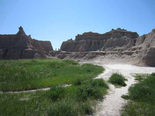
The Amish-filled hills near the head of Door Trail
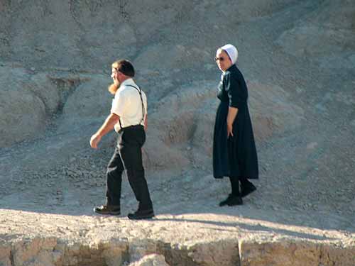
Traditional outfits
Shortly thereafter, Paul, our ranger, showed up. He absolutely loved this area, including the ridiculous heat. He said that his feet didn't even begin to warm up until it was at least 90 degrees out.
It ended up being a fairly small group, which was nice since the trail was actually an elevated boardwalk with not too much room for a large group to maneuver. Paul followed along below, pointing out various rock formations. He was a wealth of knowledge about this place... although I did manage to stump him with a couple questions.
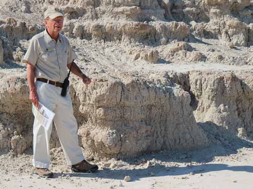
This is the Brule formation (pronounced Brool, not Brulay as in creme brulee - this was one of Paul's pet peeves).
All of the erosion is from water. The Badlands is the only park where people are free to walk and climb any and everywhere. There is no desert cryptobiotic soil to damage. And while visitors cause small rockfalls or wear down some rocks, that is nothing compared to the water erosion that results from one flood.
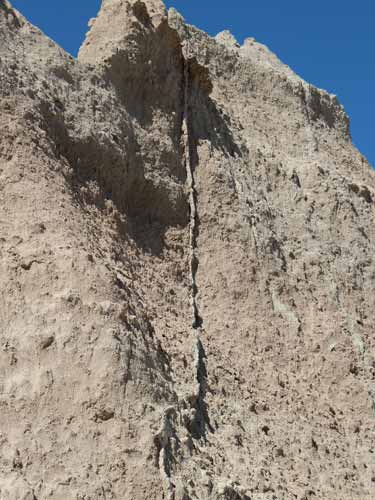
Thin ribbons of rock called clastic dikes sliced vertically through the cliffs. They are composed of a harder substance and erode at a slower rate. Why vertical? Not sure. One suggestion is that the minerals filled in existing cracks and crevices of the softer rock, rather than were a layered deposit that was once horizontal.
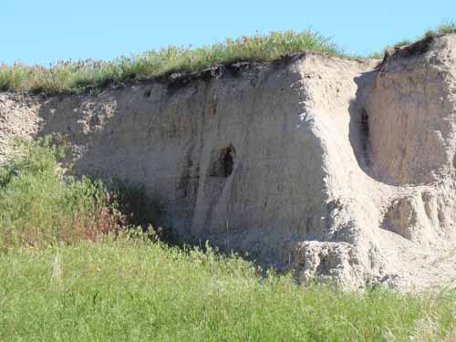
The sod tables show the height of the original prairie and the new eroded lower one. The black layer under the grass is from past prairie fires.
The entire area was greener than it had been in the past 30+ years (at least). They had been having lots of rain. In just one month, they received 5 inches. Usually the total for the entire year is only 15 or 16 inches.
We continued along the boardwalk, eventually turning the corner and getting an expansive view of the Badlands. This is where our tour officially ended, but we were allowed (and encouraged) to continue to follow the trail marked with short yellow poles. That said, Paul did warn us of the dangers of getting lost in the Badlands. He told the story of a lady who had brought her little dog with her. The dog decided to take off and run among the rocks. In spite of many days of searching, it was never seen again.
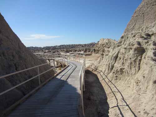
Nearing the end of the boardwalk
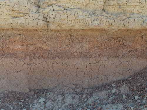
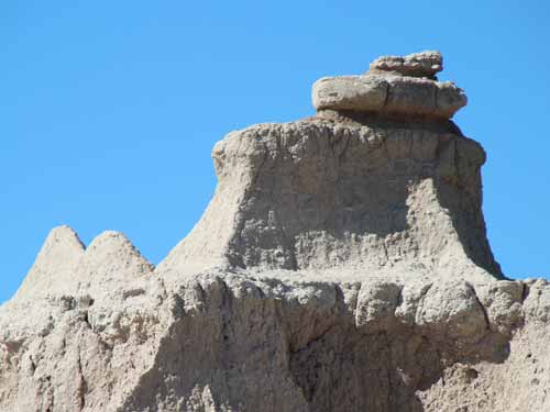
These rocks didn't used to be rocks but rather the muddy bottom of a stream bed. Over time, these sediments hardened into thick horizontal bands of greyish red stone.
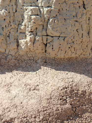
Extremely crumbly
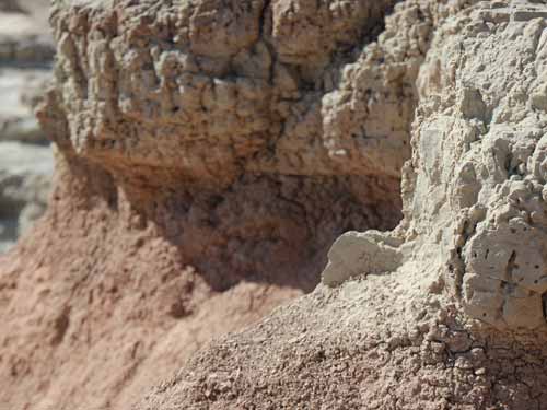
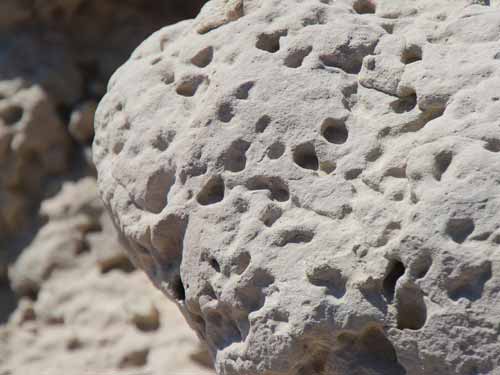
Why are these rocks full of holes? Is it eroision? Worm trails? Something else? While there are a lot of theories, nothing has been proven one way or the other yet.
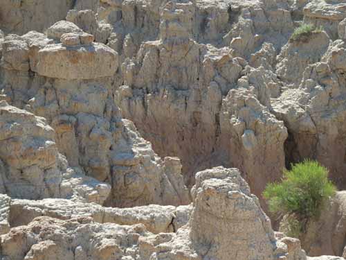
The rest of the group dispersed, but Regan and I continued to talk to Paul for a while. We mentioned how there seemed to be almost no raptors (hawks, eagles) in the parks anymore, especially Colorado National Monument. He said it was the same here. There had been a large drop in the vole population, so perhaps that had something to do with it.
We thanked him profusely for his time, info and enthusiasm, then set out into these bad lands.

The "trail"
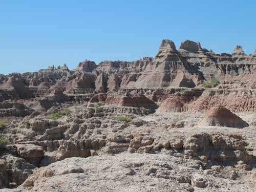
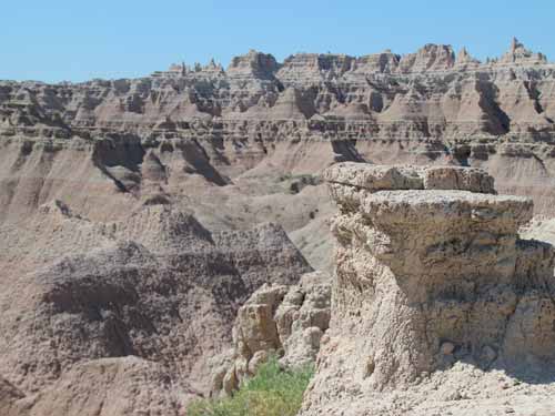
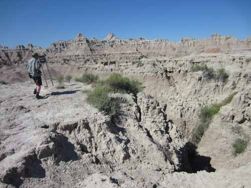
Surrounded by deep gorges
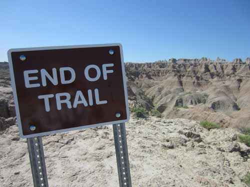
Hopefully just literally and not figuratively
We returned to the trailhead then walked up the window where the Amish people had been. We got a great view overlooking where we had just been.
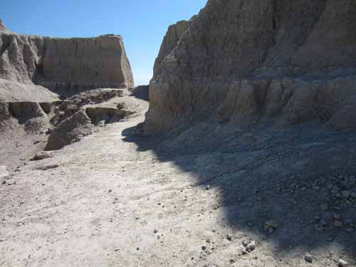
The path
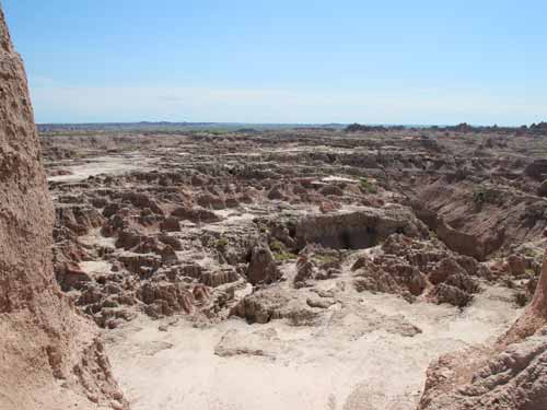
The view
It was finally time to leave these lands of badness and head toward our next destination. The drive took us through the Pine Ridge Indian Reservation, which happened to have a ranger station. So we stopped in, hoping to learn more about the local culture.
Officially called the Oglala Lakota Native American reservation, it originally was included within the territory of the Great Sioux Reservation. Established in 1889, it is currently the eighth largest reservation in the US, larger than the states of Delaware and Rhode Island combined. Granted that's not saying very much compared to the area they used to roam.
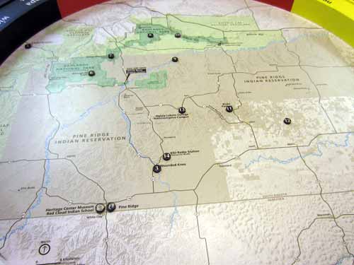
The darker beige is the reservation area. The darker green is Badlands National Park.
The Lakota people are part of a confederation of seven related Sioux tribes and speak Lakota, one of the three major dialects of the Sioux language. There is no real difference between "Lakota," "Dakota," and "Nakota." They are just different pronunciations of the same tribal name, which means "the allies." For example, one Sioux dialect has the letter "L" in it, and the other does not. Of the 13 Sioux subdivisions, seven pronounce it Lakota, four pronounce it Dakota, one pronounces it Nakota, and one is split between pronouncing it Dakota and Nakota. But they all consider themselves part of the same overall culture. "Sioux," on the other hand, comes from the Ojibway name for the tribe, which means "little snakes." Many Lakotas and Dakotas use the word Sioux to refer to themselves when they're speaking English.
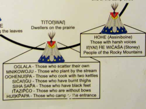
You gotta love the translations of some of these!
Each band is politically autonomous, which means it has its own land (reservation), leadership, laws, police and makes decisions independently of other Sioux bands, just like a small country. Today, the Oglala Sioux Tribe comprise about about 11% of South Dakota's citizenry.
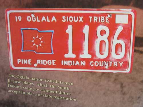
I suppose their independence stops when they leave their borders.
As we pulled up, an older man (stereotypical of the classic, modern day Indian - complete with two very long grey braids and thick accent) was animatedly talking with a group of motorcyclists. We moved in closer to hear the conversation. Apparently he was leaving tomorrow to represent his tribe in a large ceremony. It would be couple days' ride on his horse, but mostly he was concerned about having to ride through Crow territory for there might be trouble... especially if they were drunk. We later learned that in general, most of the tribes are quite friendly with each other... unless they don't get fair funding from the government.
We entered the building and spent some time with a younger ranger in his 20's. He seemed very open and was glad to answer our many questions, even the uncomfortable ones. I had always heard about the high rate of alcoholism on the reservations, so I asked. He said that unfortunately it is a very large part of their life today. Much of it was simply learned behavior... you see your family do it all around you; you grow up doing it yourself; etc. It is very difficult to get away from when it is that embedded in a culture, since part of the recovery means not associating with people who might lead you back to that lifestyle.... which would mean your family and/or your tribe. He himself was a recovering alcoholic and had been clean for one year now. His parents didn't drink, but the rest of his family did. He said it was very, very hard. But he had just graduated with an AA degree (an associate degree from a community college, usually a 2-year degree) and was turning his life around.
We walked around the exhibit, learning lots of new things.
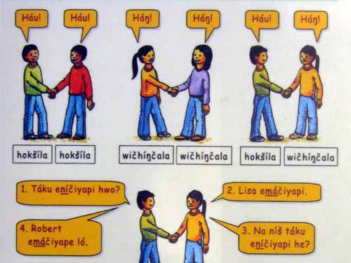
The Lakota language... they really do say "How" for Hello! Just like in the old westerns! The original inhabitants of North America spoke some 500 different languages... so clearly this was only true for a small percentage of them. But... if you ever saw the movie "Dancing with Wolves", they also say Tatanka for bison in this area!
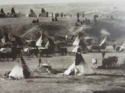
Tipis made sense for groups of people who regularly packed up their homes and moved them across hundred of miles. A small tipi used a dozen pine tree trunks as pole; a large one used over 25. Six horses were needed to drag a large tipi.
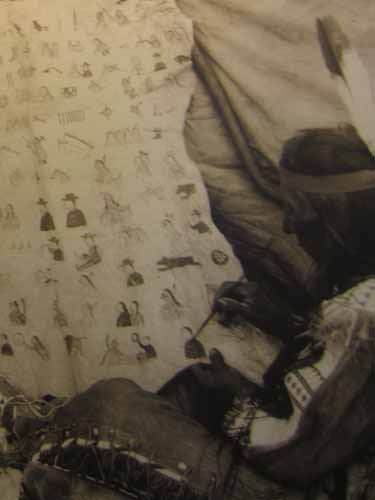
Mostly, the Lakota have kept their history passed down with oral traditions. But they did create a sort of calendar to keep track of important events over the years. It's known as a "winter count" in English, because the Lakota year began at first snow fall. The event is represented by a picture symbol.
Here are a few samples:
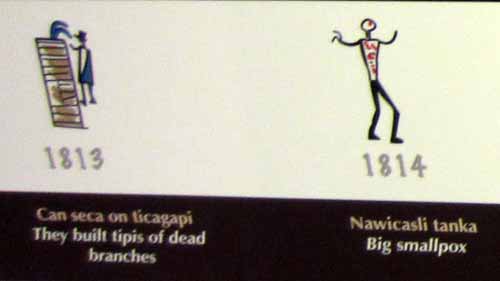
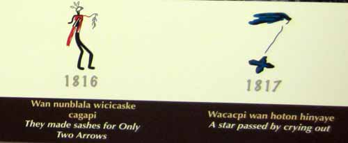
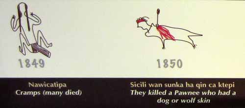
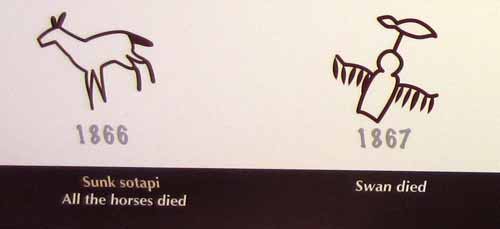
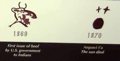
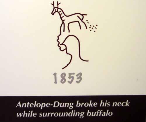
Ha ha ha!! I REALLY don't want to know how Antelope-Dung got his name!
We were going to take the "short" way to Custer State Park, but the ranger suggested we didn't because it was some 60 miles of dirt roads. So we only did about 15 miles of dirt roads before catching a paved highway again.
Originally we were planning on entering Custer State Park from the south, but the highway took us up north into Keystone. So we decided to do Mt. Rushmore instead. In town, we tried to find something vegetarian for me to eat, but with very little luck. There wasn't even the usual grilled cheese on the kid's menu. Fortunately we came across our old standby, Subway. We scarfed down our meal while sitting on a bench outside, then drove up to the top of the hill. At the gate, they said there was no fee to enter the park... but there was an $11 parking fee (with no free places to park nearby). Hmmm... sneaky way to get around honoring the parks pass that I had.

