- Saltwater Wash (mile 12) to Buck Farm Canyon (mile 41) -
We were up at 5 am to gather food from the rafts for breakfast and lunch. Bagels were on this morning's menu. I took a quick 'bath' in the frigid river. It was far too cold to stay in there for very long. Even during the scorching heat of the day, the water never warmed up.
We ate, packed up, and were on the river around 9 am.
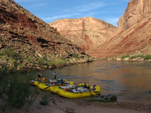
Morning at the Saltwater Wash campsite
There was a detailed list from the outfitting company about which meals to prepare for which day. Since we had to carry all the food for the entire trip with us, we had to make sure we would have enough for the final days as well.
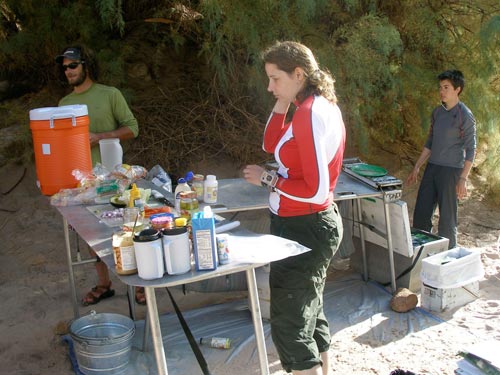
Making breakfast
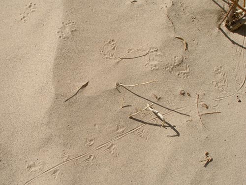
The desert is a very active place, although sometimes all that is seen of the animals and critters that live here are their tracks.
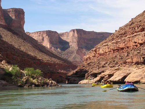
Continuing down the river
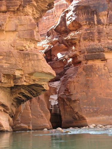
A slot canyon is a narrow canyon formed by the wear of rushing water. They are much deeper than they are wide. Most slot canyons are formed in soft sandstone or limestone.
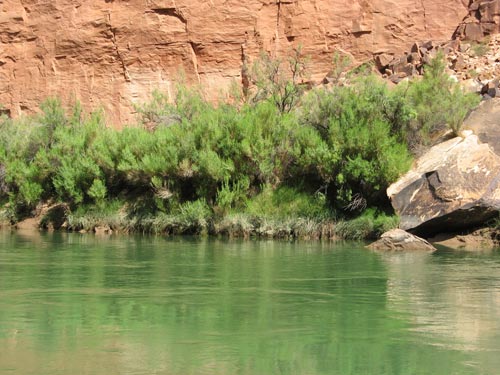
There are over 1,700 species of plants found in Grand Canyon National Park. This wide variety is largely due to the 8,000-foot elevation change from the river up to the highest point on the North Rim.
Willow, mesquite, acacia and the invasive non-native tamarisk (or saltcedar) are common. Tamarisk was introduced as an ornamental plant in the 1800's. Unfortunately its leaves secrete salt, which accumulates in the surrounding soil, impeding the growth of other plants nearby. Since 2001, volunteers have removed more than 250,000 tamarisk trees from some 130 side canyons.
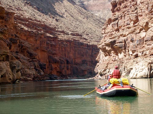
Bob stands to get a better view of Sheer Wall Rapid (a 2-3 on the rapids scale) at mile 14.3.
Because of the great volume of water and the steepness of the rapids, the Grand Canyon and other 'big water' Western rivers use a different rating system for rapids, that of a 1-10 scale. A 1 is a small riffle and a 10 is the most difficult rapid still considered runnable. More common elsewhere in the US and internationally is the Class I-VI classification of rapids.
Grand Canyon rapids rate no higher than Class IV on the international whitewater scale, meaning there is very little maneuvering required once the rapids are entered. Basically all you can do is choose a good line through the rapid, enter it properly and stay on that line.
There are 47 rapids rated 5 or higher through the Grand Canyon.
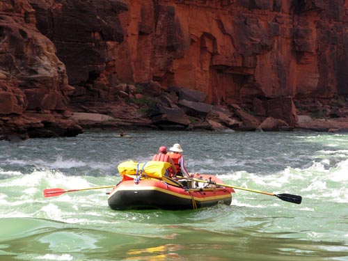
House Rock Rapid (at mile 16.9) is supposedly named after a nearby rock that is 'as large as a house'. It is a 4-7 on the rapids scale with a drop of 9 feet. Looks and numbers can be deceiving when trying to determine how difficult a run will be. The difficulty level changes depending on factors such as water level.
House Rock is located where debris from Rider Canyon enters the river. Basically, the Grand Canyon was not just carved by the Colorado River. It had the help of thousands of side creeks, streams and rivers that empty into it. Without these tributaries, a boat trip down the Colorado would be similar to a lazy float down the Mississippi River, for almost all of the Colorado's rapids occur right where tributaries empty into the river. Some of their load of sand, mud and rock moves downstream, but a lot of it remains where the side stream meets the river, resulting in a kind of bottleneck that forces the water to rush over, through and around the obstructions.
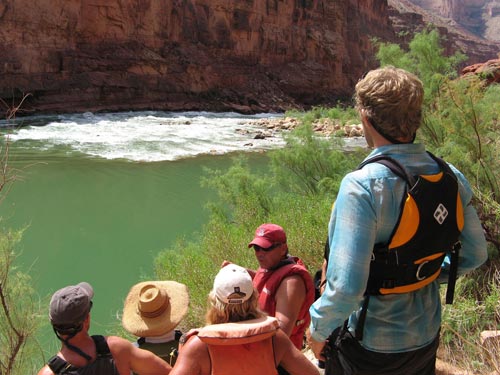
Scouting the rapid before running it is often a good idea, especially if it is new to you. From this view, it's often hard to see how big those waves are.
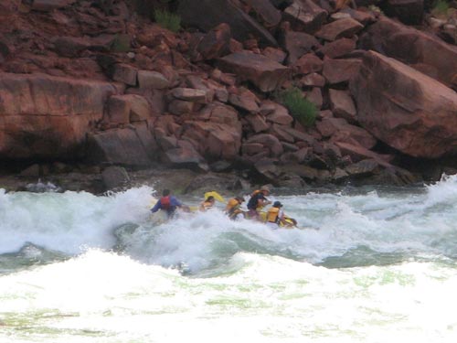
Another group of rafters tackles the rapid.
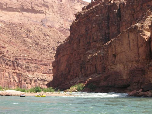
A look back at the rapid
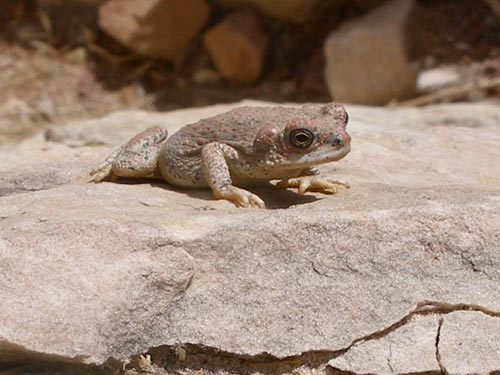
A Red-spotted Toad makes an appearance...
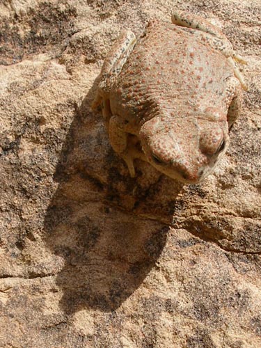
... but only if one looks closely enough! Its camouflage is very impressive.
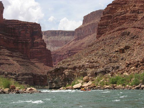
North Canyon Rapid (a 4-5 on the scale) near mile 20 is the beginning of a series of rapids known as the Roaring 20's. It has a 12 foot drop.
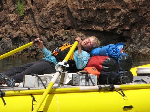
Taking a short nap between rapids
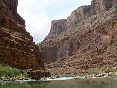
Approaching 21-Mile Rapid
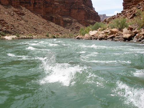
This is a 4-5 on the rapids scale with a 12 foot drop.
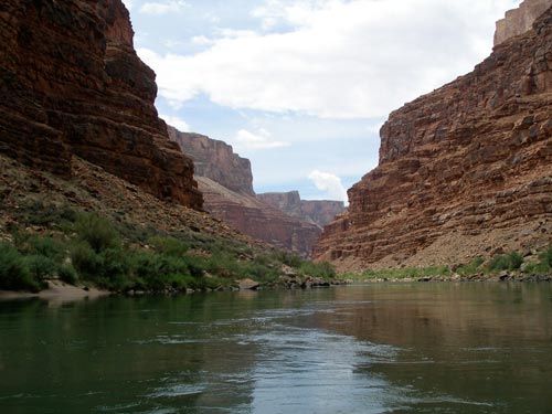
The peaceful calm between rapids
The 'green line' follows the flow of current and is the easiest path in tranquil waters. But even here one has to avoid rocks, eddies and swirlies which can be strong enough to shoot you back upstream. Since this is 'big water' (15,000 - 19,000 cubic feet per second), whirlpools can develop out of nothing. One time, John was paddeling along in his kayak when a whirlpool suddenly opened up beneath him, pulled him down, spun him about several times then released him as it disappeared just as suddenly.
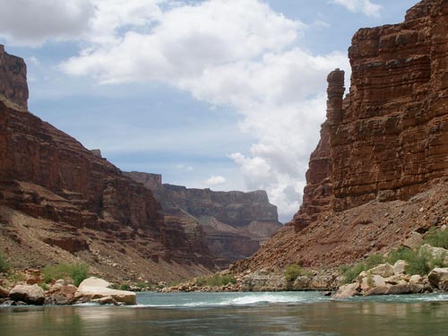
A Supai spire looms above 23-Mile Rapid (a 2-4 on the scale with a 5 foot drop).
Rocks from the Supai Group are a mixture of non-marine, red siltstones and sandstones reflecting a swampy environment, probably a coastal lowland plain crossed by streams.

Illustration of the different rock layers
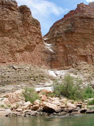
This cut in the cliff is a dry waterfall. The rainy season usually begins around the middle of July and lasts 4-6 weeks.
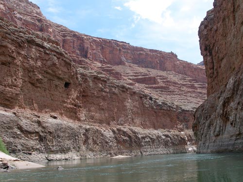
Marble Canyon is the site of one of the last great proposed dam projects on the Colorado. Proposed in the early 1950's, it was met with substantial opposition and was abandoned in 1968. Exploratory holes drilled in the redwall limestone of the canyon walls during an early phase of the investigation can still be seen.
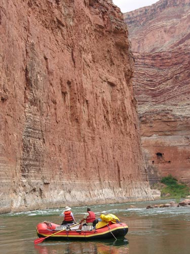
Vasey's Paradise (at mile 31.9) is a spring that flows directly out of the cliff face. It is fed by groundwater originating at the Kaibab Plateau. George W. Vasey was a botanist who served with Powell.
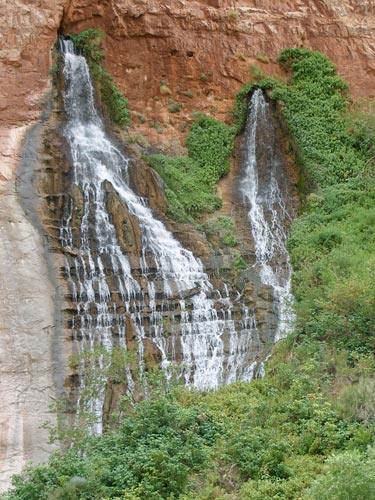
The spring supports a variety of plants, including poison ivy.
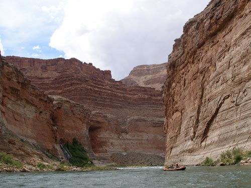
A distant view back toward the falls
Redwall Cavern (at mile 33.1) is a river cave only accessible by boat. It gets its name from the type of rock into which it is carved. We pulled the rafts up on shore and enjoyed a bit of lunch and down-time on the sandy beach. Some folks played frisbee and whiffle ball. The warm air in the cave felt really good.
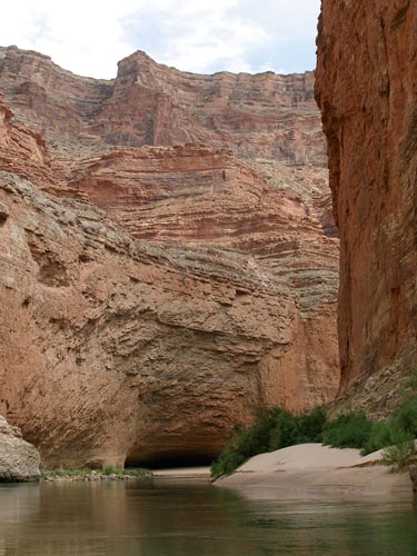
Approaching the cave
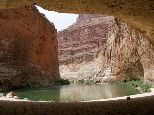
Powell estimated this cave would be big enough to seat 50,000 people... a bit of an exaggeration (it's probably more like a 1,000).
The water is still very green. Apparently we managed to escape any storm runoff. For the most part, our day has been blue sky with large, puffy clouds... only just a few drops of rain in spite of the dark storm clouds looming just behind the mesa tops.
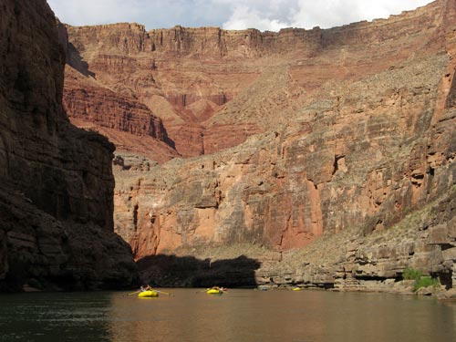
Impressive canyon walls
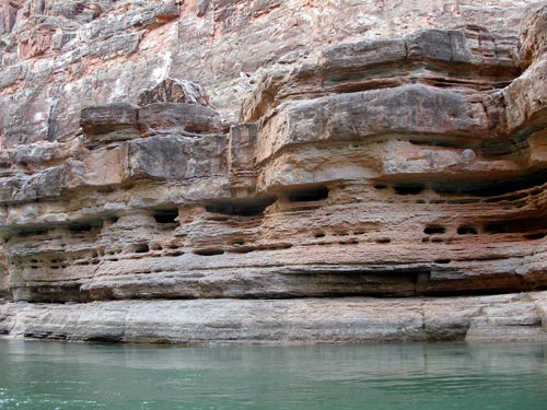
Erosion at work
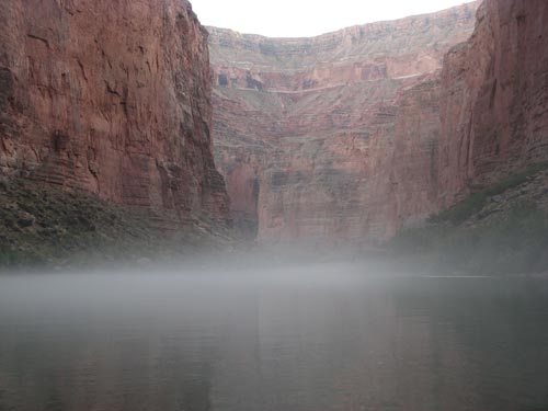
A layer of evening mist rolls in.
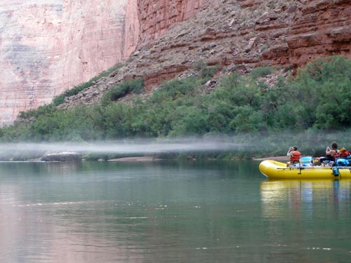
After almost 30 miles, we arrived at Lower Buck Farm. We set up camp on the fairly long beach. The site was on a bend in the river, surrounded (as is generally the case) by tall, red canyon walls.
Next we went to unload food for dinner and the next day's breakfast and lunch from the rafts. The system was terrible and we ended up not being able to find the Hollandaise sauce. Later during the trip we found a complete list of the food supplies (apparently we just had been working off a summary list) and had the oarsman help pull the food for us (instead of us clambering around on their boats digging into everything)... so it got easier.
We sat under the evening sky watching flashes of lightning. Tiny bats zipped about overhead.
return • continue

