CAPITOL REEF (Day 22 - part 1)
The only sounds all night were the crickets, a small nearby waterfall and the occasional creaking of the tipi in the wind. At 7 am was the free breakfast buffet. What a lovely way to start the day!
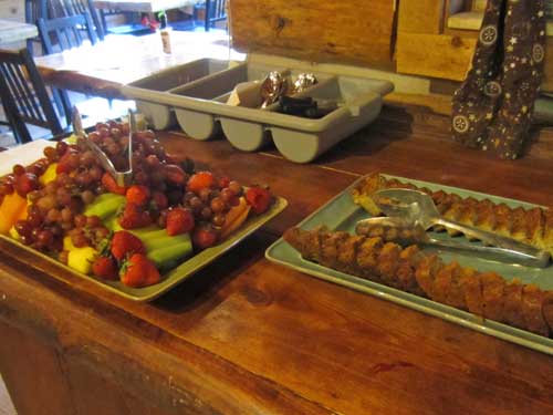
Cantaloupe, honeydew, grapes, strawberries, pineapple, and some dense yummy banana-like bread with delicious currant jam.
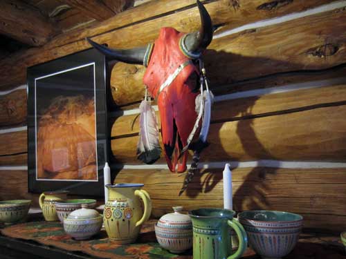
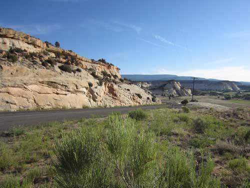
I packed up and headed out. There didn't seem to be a whole heck of a lot to Boulder... some stray houses and farms, a motel and general store or two, random cows by the side of the road. But I suppose that's not surprising given the population is a little over 200.
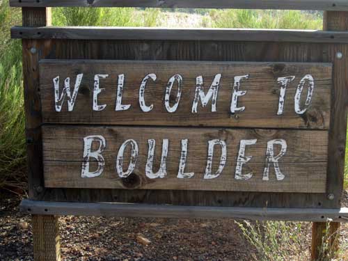
Electricity arrived for most places in 1935, but it only reached Boulder in 1947.
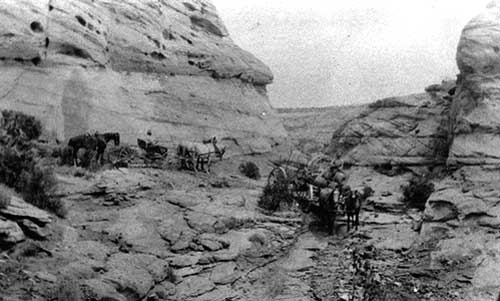
It took 3 very rough days for a wagon to get here from Escalante until Highway 12 was built in 1940. Even then, the stretch of highway north that connects with the town of Torrey on the other side of Boulder Mountain was still often closed due to snow and mud for at least 6 months a year. That ended in 1985 when the road was finally paved.
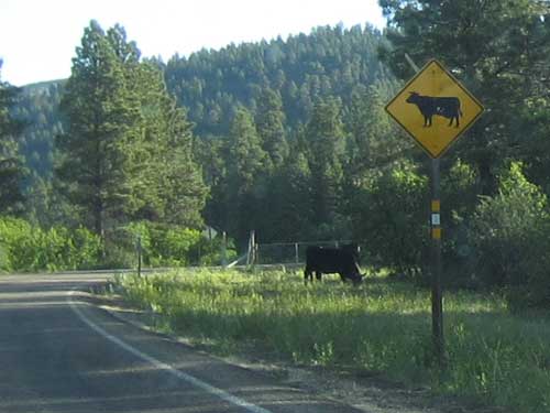
How very appropriate
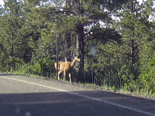
There were many cows, deer, chipmunks, rabbits and even marmots on or near road as I crossed over the mountain.
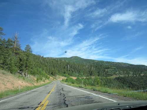
Coming down from the road summit of 9,600 feet
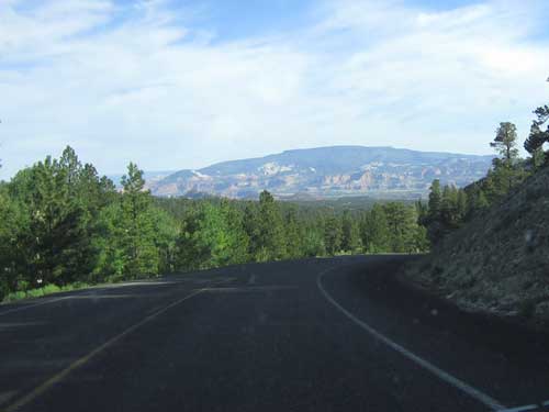
New landscapes appear in the distance as I make my way off of Boulder Mountain.
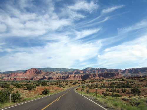
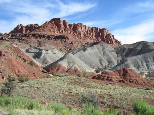
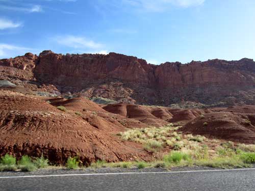
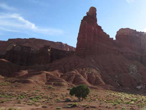
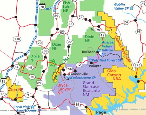
Upon entering Capitol Reef National Park, I first headed to the campground (located in the old historic Fruita district) to set up my tent. The first lot was full but there was fortunately plenty available in the adjoining lot.
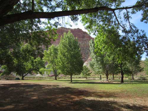
The view from my tent
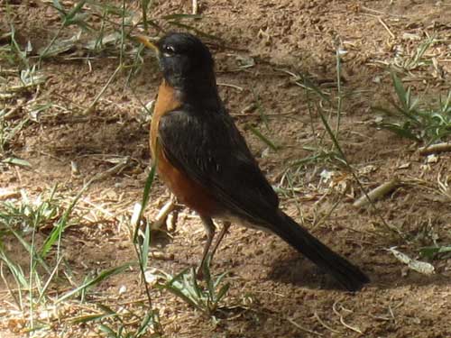
A robin hops up to greet me.
Protection of this amazing landscape began back in 1921 with two men, Ephraim P. Pectol and his brother-in-law Joseph S. Hickman. They named it Wayne Wonderland (after Wayne County where it was located) and believed that the area could attract visitors from all over the country. They sent stories and photos to any newspaper or magazine that would publish them. In 1924, Hickman was elected to the Utah state legislature and introduced a bill to have the area around Fruita designated as a state park. It passed. Next he began asking the federal government to consider it as a national monument. He unfortunately drowned in a boating accident, but Pectol continued to promote the area with scenic photography exhibits. In 1937, his efforts were rewarded with National Monument status (although the name Capitol Reef was now used). It wasn't actually opened to the public, however, until 1950. Visitation climbed dramatically after the paved State Route 24 was built in 1962, replacing the narrow wagon road about 10 miles to the south that frequently washed out. In 1971, the area became a National Park.
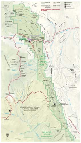
The park is 100 miles long but fairly narrow (cilck for a larger view)
I then drove to the visitor center. Generally with national parks and monuments there is a fee, usually charged at some sort of entry gate. But apparently here they are on the honor system. They let you chose to pay here, or at a kiosk, or just have your annual pass on you... then they do random spot checks out on the trails.
I arrived just in time for a geology talk.
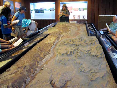
A relief map of the park showing the promient Waterpocket Fold
The Waterpocket Fold is the story about the geologic processes of deposition, uplift and erosion (primarily by water). Around 65 million years ago, the Colorado Plateau rose (caused by the same major tectonic event, the Laramide Orogeny, that created the Rocky Mountains). But it didn't snap. Instead it simply warped the earth's crust and created a monocline (a regional fold with one very steep side in an area of otherwise nearly horizontal layers). A monocline is simply a 'step-up' in the rock layers, not unlike a carpet draped over a stair step, with the rock layers on one side being higher than the other side (in this case, the layers on the west side are 7,000 feet higher than those on the east). Most of it is underground, but water has eroded it here so that we can see it.
It was given its name in 1872 by John Wesley Powell who wrote the first geological descriptions of it. Weathering and erosion have carved the Navajo sandstone into cliffs, canyons, caves... and basins or 'pockets' which collect and hold drainage water. Such basins are common throughout the fold.
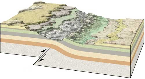
A cross section showing how the rocks have been folded and then eroded away exposing the rock layers
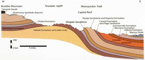
Click for a larger version
The fold forms a huge north-south barrier, especially for the early explores and settlers who were crossing the plains. They basically hit this and were stuck. Since many had had sailing experience, they called it a 'reef' which is often a barrier while sailing.
The first part of the park's name comes from a line of large white domes of Navajo Sandstone, which reminded them of the US capitol building.
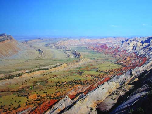
A photo of the impassible fold
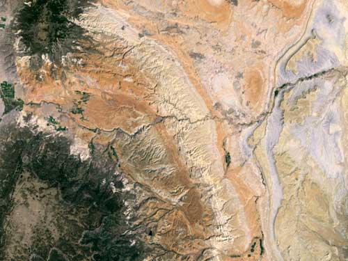
An aerial view. This is the longest exposed monocline in North America.
There are 17 exposed rock layers here, each one being a major event.
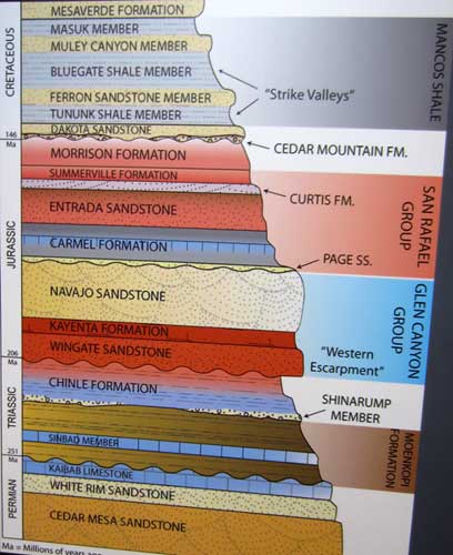
Click for a larger version
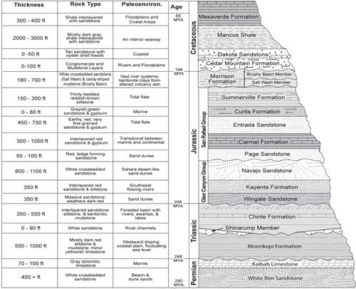
Click for a larger version
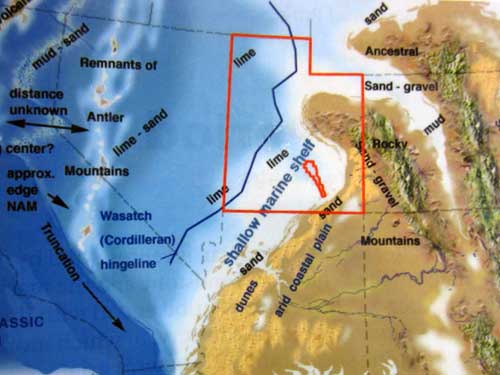
Early Permian (around 270 million years ago)
Around this time, Utah was under the sea close to equator when the supercontinent Pangea existed. Here we get Kaibab Limestone. This is the top layer of rock at the Grand Canyon, but the bottom layer here.
This great sea lasted until around 250 mya, at which point there was a mass extinction event referred to as the Great Dying or the Great Permian Extinction. This is the boundary between the Permian and Triassic geologic periods. It is identified by a white band.
It is our plant's most severe known extinction event, with up to 96% of all marine species (brachiopods) and 70% of terrestrial vertebrate species (insects) becoming extinct. Because so much biodiversity was lost, the recovery of life took significantly longer than after any other extinction event, possibly up to 10 million years. It isn't clear what exactly happened, although there is evidence of possibly several different phases... the earlier ones perhaps due to gradual environmental change (sea level change, shift in ocean circulation) while the latter one due to a catastrophic event (exploding meteor in the atmosphere, massive volcanic eruptions, coal or gas fires and explosions, a runaway greenhouse effect, etc).
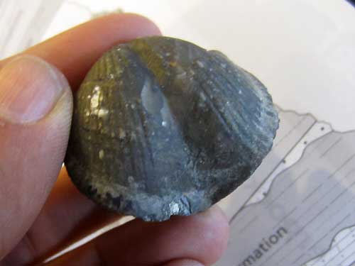
Brachiopod fossil
The next layer of rock from 245 million years ago is the dark red-brown Moenkopi, the rock of tidal flats. Here we find the mystery of the chirotherium. This is a mystery animal for which we only have fossil track marks... no bones. Our best guess was that it resembled something like an alligator.
Although it may not seem like it, bone fossils are actually quite rare. For example, of all the human bones on the planet right now, only 54 would become fossils. In the course of 3.5 billion years of history, we have only found 300,000 different species. Compare that to how many species exist just today (estimated at 8.7 million species... with a good 80% of those still not yet officially discovered).
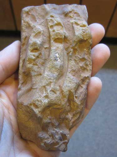
Most fossils show five toes, but ours only showed three.
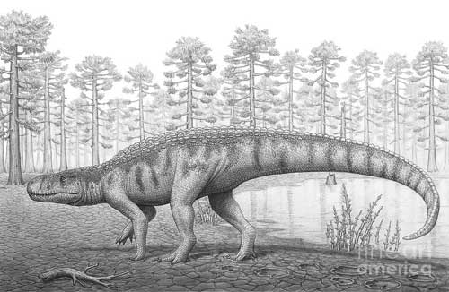
The mysterious chirotherium
We move on to 225 mya. The Chinle rock layer is that of swampy, lush conifer forests, filled with giant ferns and Monkey Puzzle trees. The forests were also thick with predators.
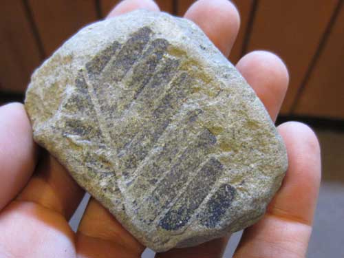
Plant fossil
Toward the end of the Jurassic period we get the Morrison Formation, known for all its dinosaur fossils. It was a time of volcanic ash and fresh water lakes.
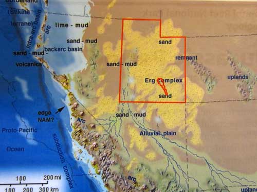
Early Jurassic (about 190 mya)
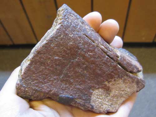
Fossil bones were often tinted purple which is due to iron-staining. Sandstone didn't let the iron actually rust, which would have otherwise turned everything red.
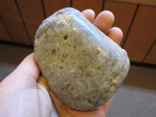
This giant rock is a gastrolith, meaning it was a stomach or gizzard stone inside a gastrointestinal tract to help grind food in animals lacking suitable grinding teeth. Imagine the size of the animal that had to swallow something that big!
Finally we arrive in the Cretaceous with its Dakota Sandstone. This area was a coastal delta.
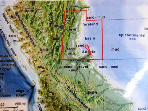
Late Cretaceous (around 90 mya)
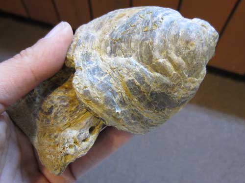
Oysters were the prominent fossils of this time.
I then watched a movie which covered the human history of the area as well. People have been around here for the past 12,000 years. Native hunters and gatherers, and eventually farmers, have been leaving their stories and art on the cliffs for over 7,000 years. The Fremont people lived here from around 600 to the 1300's. They irrigated crops of lentils, corn and squash and stored their supplies in stone granaries. Then for unknown reasons, they abandoned their homes and fields.
Many years later, the Paiutes moved in. In 1775, Spanish expeditions had to turn back because the region was more remote and difficult than expected. Then came several mapping expeditions, including John C. Fremont in 1853 and Major John Wesley Powell in 1872. Mormons settled this valley in the 1880's and established the town of Junction (renamed Fruita in 1902). They planted orchards and crops, built homes and a school, and created a settlement that supported around 10 families.
The work was hard but life was good.... yet very isolated. It took over an hour and a half to travel the 10 miles to Torrey... and that was in the best weather. Farming techniques were slow to change, and the first tractor didn't appear until the 1940's. Being self reliant proved to be a blessing, however, during the Great Depression when many other communities (those that relied on money) suffered.
Once Capitol Reef became established as a national monument in 1937, visitors began to arrive and the road was paved. The National Park Service began to purchase Fruita property still privately owned. By the late 1960's, most of this had been accomplished and many buildings were razed. All that remains now is the schoolhouse, a house and barn, and the orchards (approximately 3,000 trees which are still maintained). Unfortunately I was too early in the season since you can pick and eat all the fruit you want (provided you eat it in the orchard; there is a charge for fruit taken outside of them).
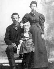
Nels Johnson had a cabin and orchard here.
I returned to the campsite to have some lunch and take a short nap in the cool shade of the trees. It is supposed to get up to 93 degrees F today. It was already quite hot everywhere that didn't have trees. This spot truly was an oasis.
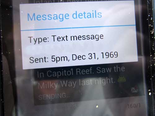
It was mentioned that cellphone reception might be poor... but they didn't say you would be in the Twilight Zone!
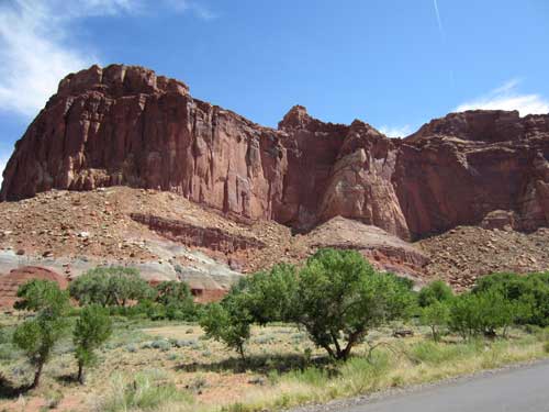
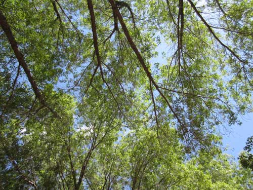
Lush and lovely!!
return • continue