PIKES PEAK (Day 1 - part 1)
How does one create a bucket list trip? Especially when it is for someone else... actually TWO someone elses, who have different needs and requirements than I do?
Step 1 - Chose an acceptable time frame.... 3 weeks sounded reasonable
Step 2 - Swap lists of ideas and wishes, taking into consideration limited walking abilities (for example, places that had lots of easy, scenic overlooks)
Step 3 - Plot everything on a map so see what creates a doable route (sacrificing those too far off the main path)
Step 4 - Plan the days with regards to driving distances, rest times and comfort needs
Step 5 - Book the hotels (no camping or couchsurfing this time!), reserve the fancy rental car (complete with working air-conditioning, lots of power and even cruise control!), and purchase any special tickets (such as the trains)
Step 6 - Thoroughly enjoy!
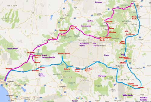
The blue line is our drive out; the pink is our drive back. The red names were the places we saw; the purple ones had to fall off the list
(Click for a larger view)
The trip begins.... We hit the road at 9 am, headed down to Manitou Springs.
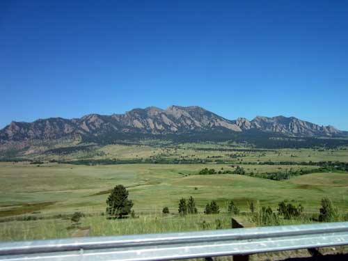
Leaving the foothills of Boulder
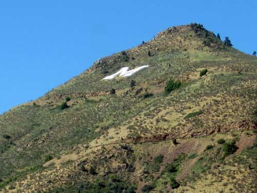
As we passed through Golden, we saw a giant M carved into the hillside. Apparently this "M-blem" appeared on Mt. Zion back in 1908 when some students from the local Colorado School of Mines returned from a trip to Salt Lake City, inspired after seeing a giant U (for the University of Utah) similarly done. Not everyone was happy with it, but the damage was done. The 104-foot by 107-foot letter with 10-foot long legs was carved with hand tools carried up by burros. In 1932, it even got a lighting system... which eventually could change colors for the holidays. In 1989, the lighting system was upgraded from 551 to 1,653 individual light bulbs. The most recent upgrade in 2003 involved computer technology; the M can now chime to the hour and can switch colors with the push of a button.
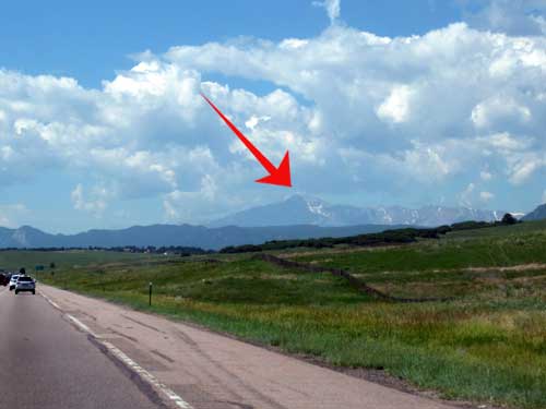
Our destination... the top of Pikes Peak!
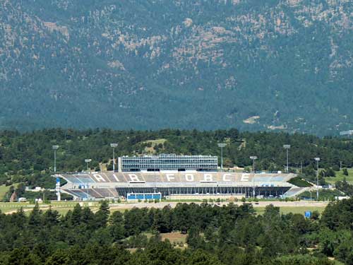
Colorado Springs is home to both US Army and Air Force bases.
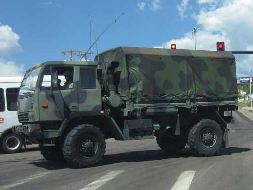
A noticable military presence
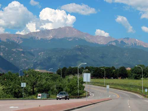
Almost there! The 'tree line' marks the end of where trees are capable of growing. In Colorado, that averages around 11,000 feet. By looking at where the trees stop in this photo, one can start to guesstimate the height of the mountain.... which in this case is 14,110 feet.
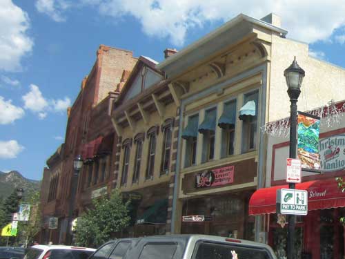
The charming town of Manitou Springs sits at the base of the mountain. It was founded back in 1872 as a 'scenic health resort.'
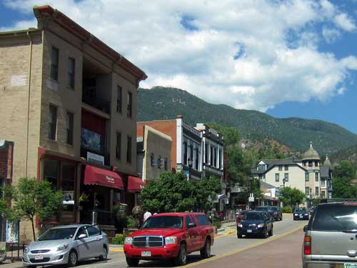
We arrived a bit early at the train depot. It was quite backed up with a long line of cars since the previous train hadn't arrived back in the station yet so there was zero parking available. We circled around the town for a bit then eventually returned and got a spot. Fortunately Bill and Joanne had brought their handicap card for the car so that parking (even in the worst of areas) was seldom a problem.
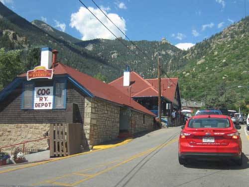
Waiting in traffic by the depot
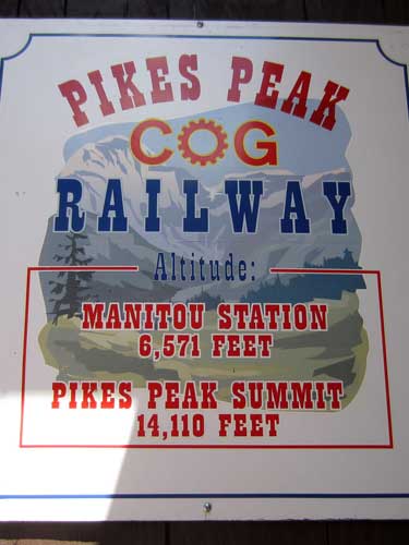
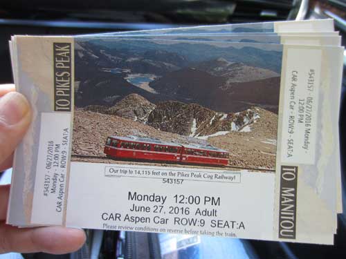
We got tickets to ride! But what were we riding?....
Some history....
Pikes Peak (so written without the seemingly required apostrophe) is named after Zebulon Pike, an early explorer of the Southwest. He first saw "The Great Peak" in the late fall of 1806. He and his men attempted to climb it, however heavy snows turned them back around 10,000 feet. He guessed the peak to be over 18,000 feet tall and believed it probably couldn't be climbed. A mere 14 years later, however, it was summited by a botanist named Edwin James.
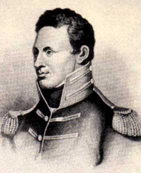
Zebulon Montgomery Pike (1779 - 1813)
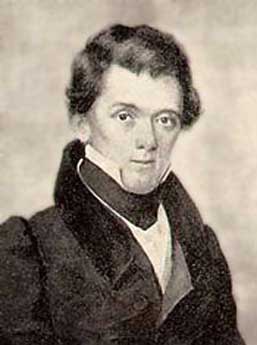
Edwin P. James (1797 - 1861)
So why isn't it called James Peak then? That's because of Major John Charles Fremont, who was head of the US Army's Topographical Corp in 1940. He felt credit should go to the person (the American person, that is; the Arapaho called it Heey-otoyoo or Long Mountain and Spanish explores had named it El Capitan) who first documented it, not just climbed it. And since he was the one making the maps, he basically just forced it to be so. But that's ok because James later got a peak named after him as well... although it's only 13,300 feet high.
It is the also the US Geological Survey and US Board on Geographic Names that killed the apostrophe. In 1890, it was declared the possessive apostrophe is not permitted in place names in order “to maintain uniform geographic name usage throughout the Federal Government.” We commoners, however, can still get away with it if we want.
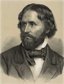
John Charles Fremont (1813 - 1890)
In 1889, a carriage road was opened. Horses brought passengers about halfway, then mules finished the journey to the top. Mr. Zalmon G. Simmons (owner of the Simmons Mattress Company) did the trip via mule to inspect some telegraph lines. It took him two days. He had such a miserable time that he decided to build a railway! He raised $1.5 million... and so the Manitou & Pike's Peak Railway was born. He charged $5 per person (which is equivalent to around $125 today). It only costs $38 today.
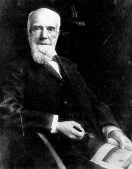
Zalmon Gilbert Simmons (1828 - 1910)
Note how the apostrophe snuck back in!
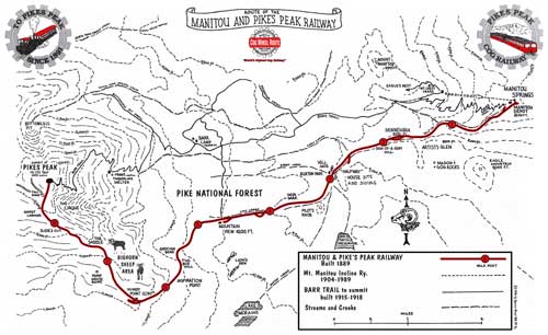
The route (Click for a larger view)
Construction began in 1889 and was completed in 1891. But this was no ordinary train; the grades were simply too steep. A rack railway (also known a cog railway) contains a toothed rack rail, usually between the running rails (which support the train's weight and for balance). The trains are fitted with cog wheels that mesh with this rail. This allows the trains to reach grades well above the 10% maximum grade of normal trains.
A number of different rack systems have been developed, but most rack railways of today (including this one) use the Abt system, designed in 1882 by Roman Abt, a Swiss locomotive engineer.

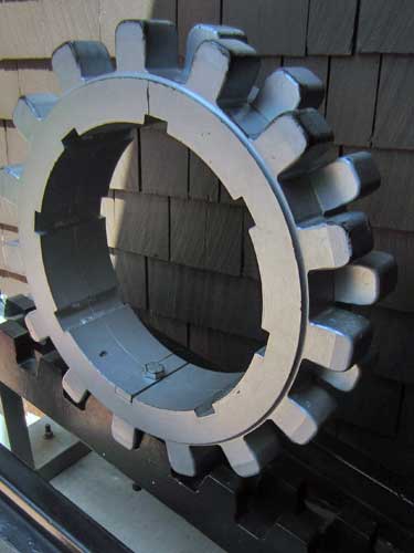
A cog...

... and the rails it fits into. Apparently 90% of outside rails are original. The cog rail is replaced every 7 years (since it's the one that does the real work).
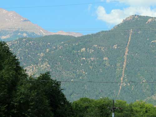
See that veertical line in the mountain? Yup, that's our path!
In 1925, ownership of the railway was transferred to Spencer Penrose (owner of the Broadmoor Hotel), making it now the Broadmoor Pikes Peak Cog Railway. Up until that point, conventional steam locomotives had been used. But these were expensive to operate. In 1938, the first gas-powered rail car came onto the scene. Today, diesel-electrics is the preferred method.

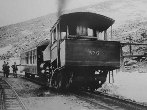
A steam train pauses for water near the summit in the late 1800's.
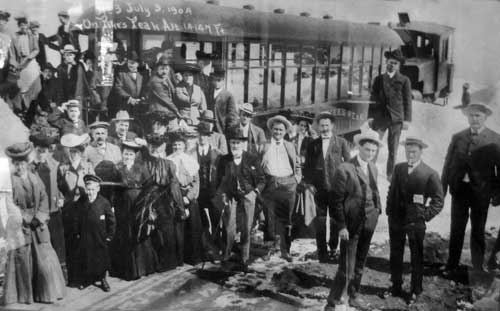
Early visitors in 1904
Some facts:
- The route is 8.9 miles.
- The steepest grade on the route is 25%.
- This is the highest standard gauge railway in North America.
(Standard gauge is 4 feet 8.5 inches... or approximately the width of a horse-drawn cart)
- The trip takes 3 hours and 10 minutes roundtrip (including a 30 minute stop at the summit).
- The train travels 10 miles per hour going up but only 8 miles per hour coming down.
- Pikes Peak is not the highest mountain in Colorado. It is 31st out of 54 mountains that reach above 14,000 feet,
the highest being Mt. Elbert at 14,433 feet.
- The altitude of Pikes Peak has changed many times over the years. Initially, it was 14,109 feet. But when the Summit House Tower was built in the late 1800's, it rose to 14,147 feet. In 1963, a new Summit House was built and the elevation dropped to 14,110 feet. In 2002, Congress adopted the "National Geodetic Vertical Datum of 1988" and the elevation changed yet again to 14,115 feet.
- The air at the top is only one-third that at sea level. It is also 30 degrees F colder at the summit.
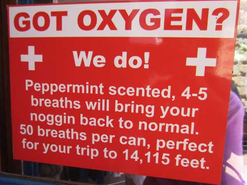
While it sounds kind of funny, this sign is actually based on rtruth. When you go too high too fast, your body cannot get as much oxygen as it needs, especially in such thin air. This causes you to breathe faster, leading to a variety of altitude sickness symptoms including headaches, loss of appetite, nauseousness, feeling weak or tired, confusion, dizziness and even passing out. It can even be fatal. Unfortunately there's no way to predict who will get it and who won't. It has nothing to do with gender or fitness level.
Once our train arrived, we climbed aboard, ready for high altitude adventure!
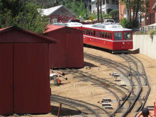
A train pulls into the depot.
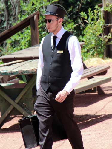

We were seated in the Aspen car. A "train" actually consists of two different cars... a single car (which we were in) and a double car (which followed separately behind us).
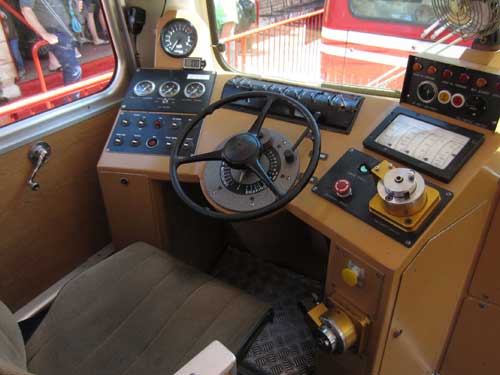
The driver's seat. There was actually one of these on each end of our car.
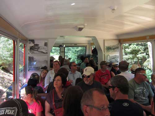
A full car!
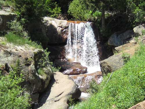
A gorgeous waterfall
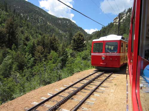
Passing another train at one of the few designated passing spots.
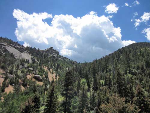
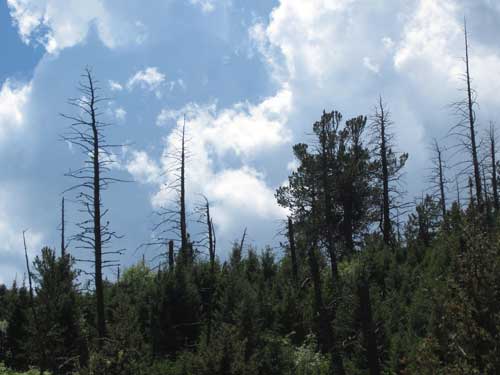
These trees were killed by a pine bark beetle epidemic in the 1970's. Many of Colorado's forests are struggling with these damaging insects today.
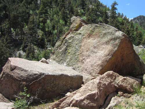
The mountain is made up of a pink granite called Pikes Peak granite. The color of the over 1 billion-year-old rock comes from large amounts of feldspar and various iron minerals.
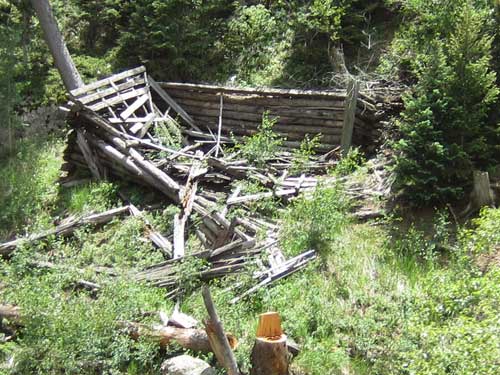
Evidence of things past
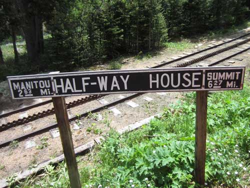
The Half-way House was a popular hotel.
Much of this area as originally homestead land. The Homestead Act allowed pioneers to purchase up to 160 acres at $1.25 per acre in return for residing on it and putting it to economic use. in 1884, Thomas and Nettie Palsgrove moved here. His two brothers bought adjacent parcels of land. By 1890, they owned a total of 560 acres on which they originally intended to ranch. But quickly that turned to tourism, serving refreshments and lodging to travelers en route to the summit. He built a hotel and a stable with burros. Once the railroad arrived, the burro trips ended... but a siding, depot and water tank were built here. The hotel was almost always full. Tom left in 1895 and his brother, John, took over. The following year, John's wife, Genevieve, filled for divorce and got most of the property, including the hotel. But only a few months later, she was electrocuted by a wet, frayed electrical cord. The property was eventually sold in 1916 but partially burned by vandals in 1922. It was dismantled in 1926 so its materials could be re-used.
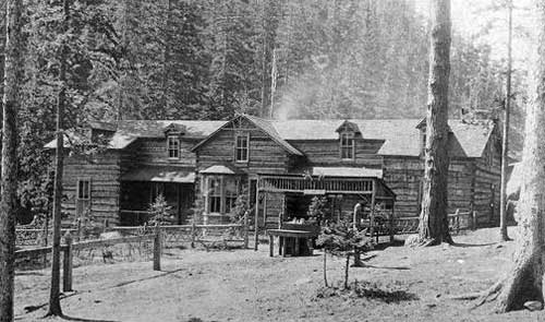
The Half-way House at Ruxton Park circa 1916
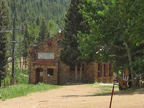
"Colorado Springs Municipal Plant No. 3" - The Manitou Hydroelectric Plant, which rests along Ruxton Creek, is a historic hydroelectric generating station. It was built in 1925 for $16,866 by the city of Colorado Springs. Various caretakers lived up here for six months out of the year from 1930 to 2008, when the plant was fully automated. The drive leading up to the plant is a rustic, 50-mile long dirt road!
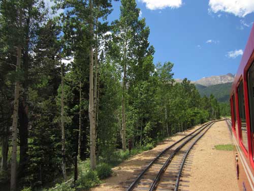
Aspens line the way.
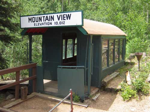
The Mountain View Siding. A siding is a short stretch of railroad track used to enable trains on the same line to pass.
return • continue